The Tech Stack Behind A Modern Surveying Drone
Modern surveying drones aren’t just flying cameras.
They’re flying computers… loaded with sensors, radios, GPS receivers, processors galore that integrate into providing survey-quality data outputs. It’s the technology package onboard each vehicle that really differentiates a toy quadcopter from one that can map a 500-acre mine site in an afternoon.
As you can imagine, the demand for this technology is skyrocketing. The global drone surveying market size is expected to reach $11.49 billion by 2035, from slightly less than $2 billion this year.
Ok then, whats really inside a contemporary survey drone? Time to dissect this bird by bird.
Here’s what’s coming up:
- The Flight Controller (The Brain)
- Positioning Systems & Wi-Fi Positioning and Analytics
- Survey Sensors & Payloads
- Data Links, Radios & Telemetry
- The Software Stack
- Why NDAA Compliance Matters
The Flight Controller: The Brain Of The Operation
Every surveying drone starts with a flight controller.
This is the on-board computer that controls everything. It receives input from the GPS, IMU, barometer, and other sensors… and makes microsecond adjustments to keep the aircraft level and on track.
Professional surveying drones use industrial-grade flight controllers like Pixhawk or CubePilot. These give surveyors:
- Reliable autonomous flight planning
- Fail-safe return-to-home behaviour
- Geofencing and altitude limits
- Mission logging for compliance
Here’s the thing:
A single surveying flight could fly over 200+ acres. If the controller hickeys half way through the flight, you lose hours of survey data and need to re-fly the entire site. Professional operators take firmware quality VERY seriously.
Positioning Systems & Wi-Fi Positioning and Analytics
This is where modern surveying drones really shine.
Consumer drones use consumer-grade GPS which can get you within a few metres of where you need to be. Good enough for selfies. Not good enough for surveying land. Professional drones fuse positioning systems together to achieve centimetre accuracy.
The core positioning stack includes:
- Multi-band GNSS receivers: picking up GPS, GLONASS, Galileo, and BeiDou satellites at once
- RTK or PPK corrections: pushing raw GPS data from metre-level down to centimetre-level
- Inertial Measurement Units (IMU): measures pitch, roll and yaw thousands of times per second
- Wi-Fi positioning and analytics: bridging gaps when GPS fails
Wi-Fi Positioning and Analytics is the unsung hero in all of this. GPS signals lose track when flying near skyscrapers, bridges, and heavy tree canopy. Wi-Fi positioning interpolates from the signal strength and timing off access points near the drone to continue tracking its location even when the satellites have lost sight of it.
If you are a surveyor doing federal work or surveying critical infrastructure, your positioning hardware must come from approved vendors. This is why you need an American-made NDAA compliant drone. Chips, radios, firmware, etc all need to come from trusted supply chains, otherwise the data your drone is collecting cannot be used for purposes on government contracts.
New data from industry leaders reveal that when RTK or PPK is used correctly, pro drones achieve 2-5 cm accuracy. That’s the difference between a survey that gets accepted or one that gets returned for a refly.
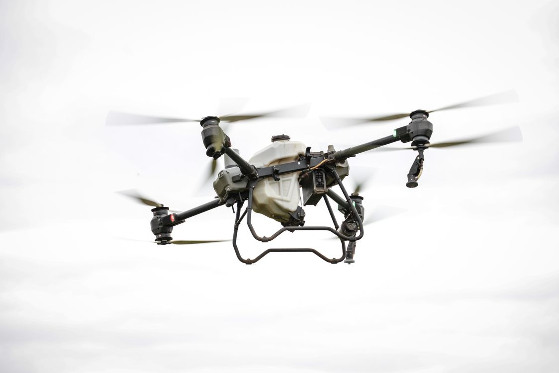
Sensors & Payloads: The Heavy Lifting
The positioning system tells the drone where it is.
Sensors give it information about what’s around it. This portion of the tech stack actually gathers your survey information.
The most common payloads on modern surveying drones are:
- RGB cameras: for photogrammetry and high-res mapping (24-100MP sensors are common)
- LiDAR scanners: firing laser pulses to build dense 3D point clouds
- Multispectral sensors: for agriculture, forestry, and environmental work
- Thermal cameras: for solar farm inspections and roof surveys
- Methane and gas detectors: for oil, gas, and utility inspections
Every payload streams raw information back to an onboard storage device. One LiDAR flight can produce 50-100GB of point cloud data in less than an hour… The drone needs fast SSD storage and a method to dump it back into at the office quickly.
Tip: Tool-less payload swaps allow drone crews to quickly change from LiDAR to RGB to thermal payloads in minutes between flights.
Data Links, Radios & Telemetry
A surveying drone is useless if it can’t talk to the ground.
Two separate radio links are usually running at the same time:
- Command and control: how the operator sends flight instructions
- Video and telemetry: how the drone streams live video and status data back
Long distance survey missions require radios capable of maintaining a stable link out to 5-10 km. This requires professional grade telemetry modules with adequate antennas, not the low-cost radios found on hobby drones.
The integration of 5G and LTE connectivity is also now commonplace on enterprise grade platforms. This allows the drone to “phone home” over cellular networks, a game changer for fleet operators running flights at numerous sites simultaneously.
The Software Stack
The hardware gets the data. The software makes it useful.
A modern surveying drone touches at least three layers of software during a mission:
- Mission planning software: where you draw out the flight path before takeoff
- Onboard firmware: which runs the actual flight in real time
- Post-processing software: which converts raw data into project deliverables such as orthomosaics, DEMs, and point clouds
Some examples are Pix4D, DroneDeploy, and Trimble Business Center. Many work in-cloud these days allowing survey teams to process massive datasets without investing in high-end workstations.
Rule number one? Choose hardware that integrates with your existing software suite. Closed ecosystems might be cheaper initially, but expensive in the long run.
Why NDAA Compliance Matters
Here’s the thing most new surveyors don’t realise…
If you plan to operate drones on federal projects, critical infrastructure, or any government funded contract then your drone must be NDAA compliant. These restrictions have become even more expansive. The American Security Drone Act took these restrictions across all levels of government and went into full enforcement at the end of 2025.
What that means in practice:
- No Chinese-sourced flight controllers
- No Chinese-sourced GNSS receivers
- No Chinese-sourced radios
- Full supply chain documentation must be available
Surveyors were caught completely by surprise by these regulations. Fleets had to be scrapped and refitted overnight.
If you are planning on doing federal work (or will be in the next couple years), purchase an NDAA compliant platform from day one. It will save you money instead of having to purchase another platform later.
Bringing It All Home
A modern surveying drone is way more than a flying camera.
A sophisticated tech stack – flight controllers, positioning systems, sensors, radios, and software that all seamlessly integrate to produce centimetre-level accurate data. When designed correctly, the prize can be winning contracts that otherwise go to your competitors.
To quickly recap, the key components are:
- A reliable flight controller with solid firmware
- A multi-band GNSS system backed by Wi-Fi positioning and analytics
- The right payload for your survey type
- Long-range radios and telemetry
- A software stack that plays nice with your existing workflow
- NDAA-compliant hardware if you want federal contracts
If you focus on these six items your drone will quickly pay for itself on just a few projects. Miss them and you’ll be re-fly-ing sites and losing bids to surveyors who didn’t forget.